(91)西都原古墳群特集・②第1古墳群(35号墳→46号墳)


(91) Special feature on the Saitobaru Kofun Group (2) The 1st Kofun Tumulus Group (Mound No. 35 → Mound No. 46)
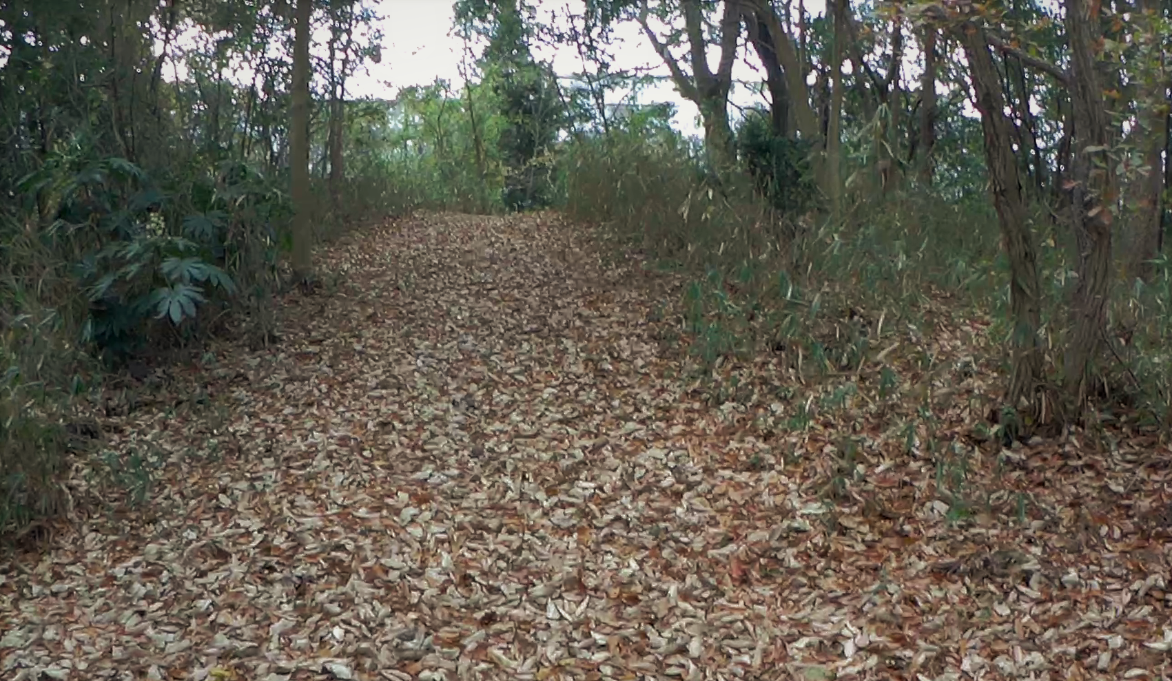
第1古墳群・35号墳

The 1st Kofun Tumulus Group, Tumulus 35


柄鏡型前方後円墳
全長70m、後円部直径38m・後円部高さ6.7m


Mirror-shaped posterior frontal mound
Total length 70 m, diameter of the back circle 38 m, height of the back circle 6.7 m


埋葬施設は後円部墳頂から粘土槨
直刀・鉄剣・方格規矩鏡・勾玉・管玉・土師器等が出土


Burial facility: clay burial chamber at the top of the back-round mound
A straight sword, an iron sword, a rectangular mirror, a jade ball, a tube ball, and earthenware were excavated.


築造AC310-390年ごろ(4世紀)


Constructed around 310-390 AC (4th century)
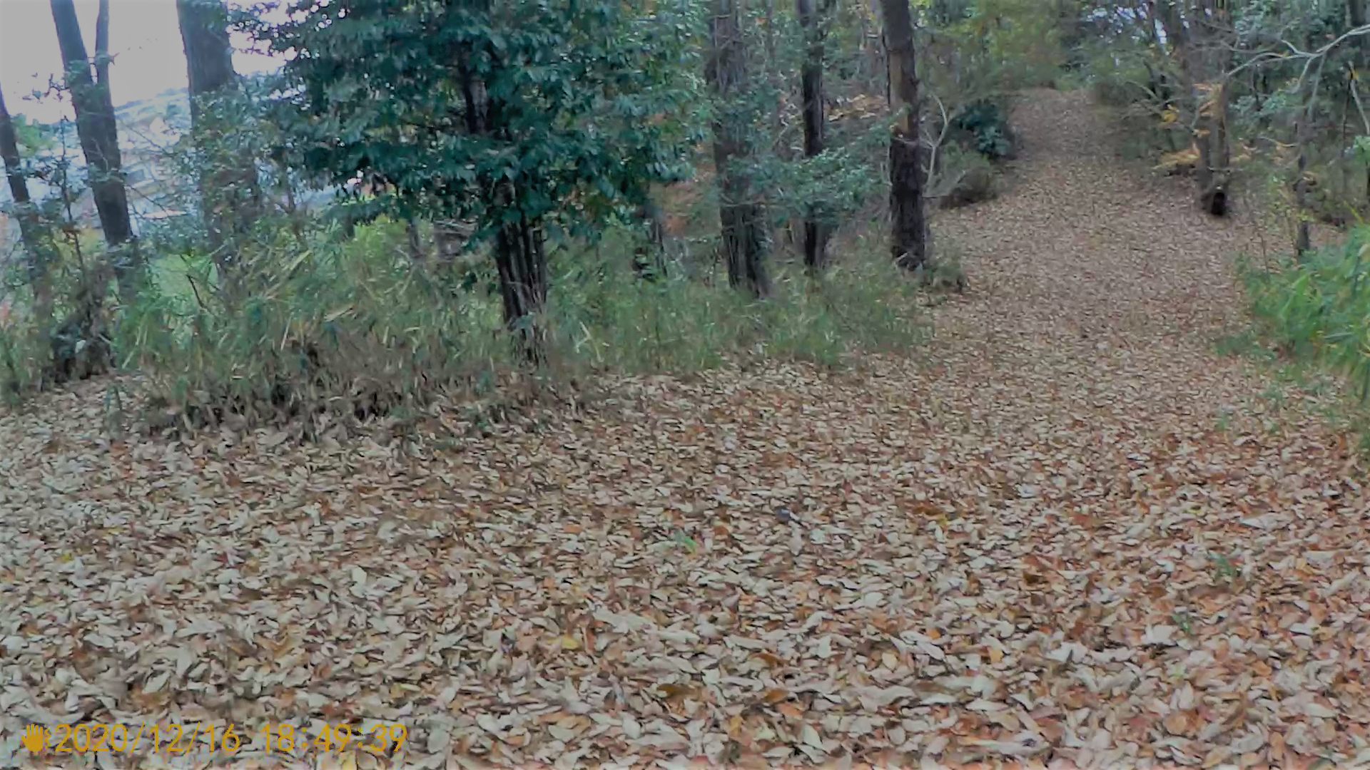
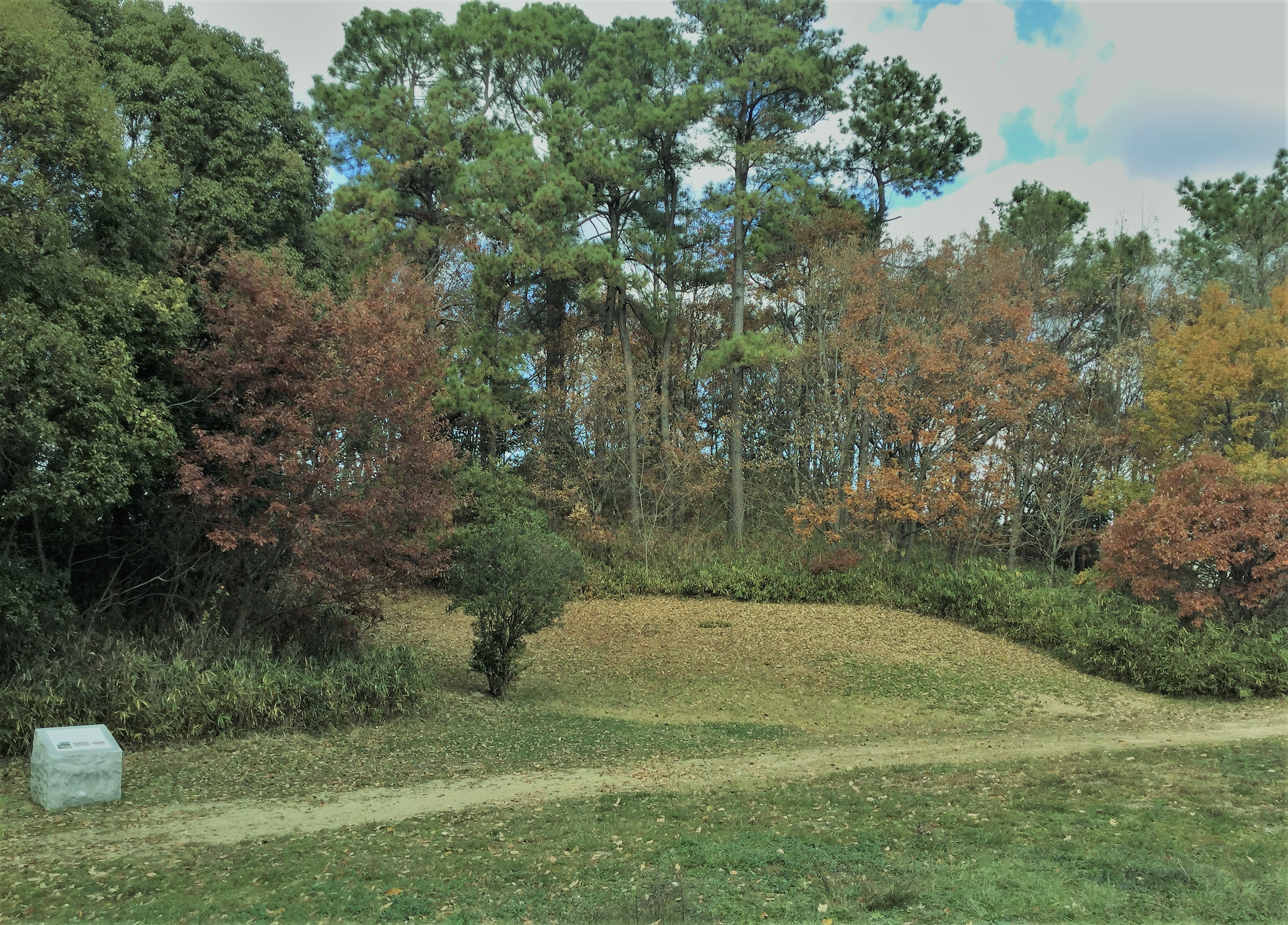


第1古墳群・46号墳


Tumulus No. 1, Mound 46


第1古墳群の中で一番新しく最大の前方後円墳
全長83.6m、後円部直径49.8m・後円部高さ7.6-7.8m
前方部幅36.4m・前方部高さ5.5m、くびれ部幅19.0m


This is the newest and largest tomb in the 1st Kofun Group.
Total length 83.6 m, diameter of the back-round 49.8 m, height of the back-round 7.6-7.8 m
Width of the anterior part 36.4 m, height of the anterior part 5.5 m, width of the neck 19.0 m


後円部の下段に葺石の黒い帯(基底石)が見える
 

前方部・後円部ともに3段築成で、墳丘斜面は緻密な葺石でおおわれ
葺石の基底石(根石)が格段に廻り最下段で二重にまわっていた。


Both the anterior and posterior sections were built in three stages, and the slopes of the mound were covered with dense thatched stones.
The slopes of the mound were covered with dense thatched stones.


前方部の浅い周溝


墳丘のところどころにつぼ型土器が据えられていた。
浅く立ち上がりの明瞭でない周溝を有する。


Pottery in the shape of a jar was placed in various places on the mound.
It has a shallow circumferential ditch with an indistinct rise.


埋葬施設は後円部の墳頂中央に方形の土坑を確認


As for burial facilities, a square clay pit was found in the center of the top of the rear circle.


くびれ部の右側に47号墳の小さな高まりが見える


築造はAC360-440年ごろ(4世紀末~5世紀初頭)


It was built around 360-440 AC (late 4th century - early 5th century).


引用/現地説明版・一般財団法人みやざき公園協会「特別史跡公園西都原古墳群」HP・全国遺跡報告総覧


Reference: Local explanation, Miyazaki Park Association "Special Historic Site Park Seitobaru Tumulus Group" HP, Nationwide Site Report General Guide

翻訳/Deep pro

(90)西都原古墳群特集・①第1古墳群

(1号墳→72号墳→13号墳)


(90) Special feature on the Saitobaru Kofun Group (1) The 1st Kofun Tumulus Group (Tumulus No.1→Tumulus No.72→Tumulus No.13)


今回から西都原古墳群を第1・第2・第3古墳群ごとに、

写真を治めた古墳のみご紹介したいと思います。


Starting this time, I would like to introduce the Saitobaru Kofun Tumulus Group by the 1st, 2nd, and 3rd Kofun Tumulus Groups, and only the tumuli that I have managed to photograph.


西都原古墳群とは

南九州の太平洋側、現在の宮崎県日向(ひゅうが)地域にある。
前方後円墳31基、円墳279基、方墳1基、地下式横穴墓11基、横穴墓12基の古墳が

4~7世紀前半にかけて築造されたと推定されている。
これほど大規模な古墳群は他にないのでは!
また同古墳群はヤマト政権の傘下にある地域豪族の墳形の象徴である

典型的な前方後円墳と、前方後円形が定まる前の古墳時代前期に多く見られる

「柄鏡形」(前方部が低く細長い)がほぼ同時期に築造されているとのこと。


What are the Saitobaru Kofun Tumulus Group?
The Saitobaru Kofun Tumulus Group is located on the Pacific side of southern Kyushu, in the Hyuga region of present-day Miyazaki Prefecture.
It is estimated that 31 anterior and posterior circle tombs, 279 round tombs, 1 square tomb, 11 underground side-hole tombs, and 12 side-hole tombs were built between the 4th and early 7th centuries.
There is probably no other such large-scale tumulus group!
In addition, the same tomb mounds were constructed at about the same time as the typical anterior and posterior round tombs, which symbolize the tomb forms of the local powerful clans under the Yamato regime, and the "scapular" tomb mounds (with a low, elongated front part), which are often seen in the early Kofun period before the anterior and posterior round tombs were established.


第1古墳群・1号古墳


13号墳の後円部から見た1号墳


発掘調査報告書等を見つけられなかった。
写真も遠方からのご紹介ですが、墳形は柄鏡形前方後円墳で、


長さは50m以上と推定される。
築造は第一古墳墳で一番古いというからには4世紀中ごろということか?


First Tumulus Group, No. 1 Tumulus

I was unable to find any excavation reports.
The photo is also from a distance, but the shape of the tomb is a forward and backward circular tomb with a scapular shape, and it is estimated to be over 50 meters long.
It is said to be the oldest of the first burial mounds, so does that mean it was built in the middle of the 4th century?


第1古墳群・72号墳(別名・一本松塚古墳)


柄鏡式前方後円墳
長さ79m 後円部直径50m・後円部高さ7.4m・前方部高さ4.6m
二段構築で葺石あり、造り出しはないが周壕あり
築造はAC360年~390年ごろ(4世紀末ごろ)
埋葬施設は後円部の磯床から直刀、粘土槨から直刀・剣・方格規矩鏡、

槨外から土器が出土。

また前方部の磯床からは剣・鉄鏃が、粘土槨から直刀・鉄鏃が出土。


First Kofun Tumulus Group, Mound No. 72 (also known as Ipponmatsuzuka Kofun)

Front and back round burial mound of the patterned mirror type
Length: 79m, diameter of the back-round: 50m, height of the back-round: 7.4m, height of the front-round: 4.6m
Two-tiered construction with thatched stones, no built-up area but with a shelter.
Built around 360-390 AC (around the end of the 4th century)
As for burial facilities, a straight sword was excavated from the burial chamber, a straight sword, a sword and a rectangular mirror from the clay burial chamber, and pottery from outside the burial chamber. Swords and iron arrowheads were excavated from the anterior burial chamber, and straight swords and iron arrowheads were excavated from the clay burial chamber.


第1古墳群・13号墳(50回でご紹介済み)


柄鏡型前方後円墳
後円部の高さに比べ前方部は低く長いのが特徴
墳丘は築造当時の形に復元されている。
後円・前方ともに3段築成で、段は連続している
長さ79.4 m、後円部の直径43.2m・高さ7.2m、前方部の長さ38.6m・幅25m
埋葬施設は竪穴式の粘土槨
出土物は、三角縁神獣鏡1面、翡翠製勾玉2点、碧玉製管玉40点余り、ガラス製小玉多数、鉄剣、刀子、棺材と思われる木片等
築造はAC36年~390年ごろ(4世紀後葉頃)


Tumulus No. 13, 1st burial mound group (already introduced in Vol. 50)

Mirror-shaped posterior frontal mound
The front part of the mound is low and long compared to the height of the back part.
The mound has been restored to its original shape at the time of its construction.
Both the posterior and anterior sections are built in three stages, and the stages are continuous.
Length: 79.4 m, diameter of the posterior circle: 43.2 m, height: 7.2 m, length of the anterior circle: 38.6 m, width: 25 m
The burial facility is a pit-type clay burial chamber.
Finds include a triangular-rimmed mirror, two jade beads, more than 40 jasper beads, many small glass beads, an iron sword, a sword, and a piece of wood that may have been used as coffin material.
Constructed around 36-390 AC (late 4th century).


次回は第1古墳群・35号墳→46号墳


Next time: The 1st Kofun Tumulus Group, Mound No. 35 → Mound No. 46


引用/現地説明版・一般財団法人みやざき公園協会「特別史跡公園西都原古墳群」HP・全国遺跡報告総覧


Reference: Local explanation, Miyazaki Park Association "Special Historic Site Park Seitobaru Tumulus Group" HP, Nationwide Site Report General Guide


翻訳/Deep Pro
 

(89)島根県の古曽志大谷1号墳(前方後方墳・破壊後に復元)

姥ケ谷古墳群


(89) Kososhi-Otani No.1 Tumulus (Posterior frontal tomb, restored after destruction) and Ubagaya Tumulus Group in Shimane Prefecture


島根県の宍道湖北岸の丘陵地に「古墳の丘古曽志公園」がある。
古曽志寺廻田西古墳群・姥ヶ谷古墳群・古曽志廻田古墳群・古曽志大塚古墳群が史跡公園として保存・一部復元されている。


In the hills on the northern shore of Lake Shinji in Shimane Prefecture, there is the Kososhi Park of Kofun-no-oka.
The Kososhi Teramawata West Tumulus Group, the Ubagaya Tumulus Group, the Kososhi-Mawata Tumulus Group, and the Kososhi-Otsuka Tumulus Group have been preserved and partially restored as a historic site park.


その史跡公園の目玉が古曽志大谷1号墳。


The centerpiece of the park is the first Kososhi Otani tomb.


全長45.5mの前方後方墳で、築造はAC460-490年ごろ(5世紀後半)。
墳丘は,基本的に尾根頂上の地山を削り出し, 

さらにその削った上を盛り上げることによって2段に築成された。


It is a 45.5 meter-long forward and backward mound, built around 460-490 AC (late 5th century).
The mound was basically constructed in two stages by carving out the ground at the top of the ridge and then raising the ground on top of the carving.


前方部から後方部を望む


急峻な45度の斜面


後方部の幅は、24-25m・くびれ部で23m・高さ5m以上、前方部は、長さ20.5m,くびれ部でおよそ21m前後で幅は30m前後と推定され,かなり前方部が発達した形態。
斜面は全体的に急竣で40~45°に達する
部分もある


The width of the back part is 24-25m, 23m at the neck part, and more than 5m high, while the front part is estimated to be 20.5m long, 21m at the neck part, and 30m wide.
The slope is generally steep, reaching 40 to 45 degrees in some parts.


階段の手前が造り出し


人頭大の葺石をもち,墳頂や段の上,墳裾には円筒埴輪を廻らしていたと考えられる。
珍しいのは前方部から長さ5.5m,先端部幅9.5mの造り出しがあったことで、

埴輪列と須恵器や土師器片を確認。


It has a thatched stone the size of a human head, and it is thought that cylindrical terra-cotta clay wheels were placed on the top of the mound, on the top of the steps, and at the foot of the mound.
What is unusual is that there is a 5.5m long and 9.5m wide overhang from the front part of the mound, where rows of clay figurines, Sue ware and earthenware fragments were found.


埋葬施設は、後方部は流出したと考えられるが、

前方部墳頂には礫が敷かれており、その下から礫椰が発見された。
棺内からは鉄製大刀1,刀子2,鉄斧、棺外の礫の上から鉄鏃が約40本出土。


The back part of the burial facility is thought to have been washed out, but the top of the front part of the mound was covered with gravel, and gravel palms were found underneath.
Inside the coffin, an iron sword, two swords, an iron axe, and about 40 iron arrowheads were found on the gravel outside the coffin.


この貴重な古墳は、発見当初から学者や市民から保存運動等が起こされたが、団地造成が優先され破壊されてしまったが、のちに200mほど東に史跡公園として復元された。


From the time of its discovery, scholars and citizens campaigned for the preservation of this valuable burial mound, but it was destroyed in favor of the construction of a housing complex, but was later restored as a historical site park about 200 meters to the east.


方墳3基がある姥ケ谷古墳群


史跡公園駐車場から階段を上ると方墳3基がある姥ケ谷古墳群を経て

古曽志大谷四号墳の模型、そして古曽志大塚1号墳にたどり着く。


Ascending the stairs from the parking lot of the historic site park, you will pass the Ubagaya Tumulus Group, which has three square mounds, and reach the model of the fourth tomb of Kososhi Otani and the first tomb of Kososhi Otsuka.


眼前に宍道湖が広がる
 

古墳の頂上からは神が宿る山としてあがめられてきた「朝日山」、

南には「宍道湖」を見渡すことができる。


From the top of the burial mound, you can see Asahiyama, which was revered as a mountain where gods resided, and Lake Shinji to the south.


引用/古曽志遺跡群発掘調査報告書(全国遺跡報告総覧)・神々のふるさと山陰観光ポータルサイト


Reference: Kososhi Site Group Excavation Report (Nationwide Site Report), San'in Sightseeing Portal Site, Home of the Gods


Translation: DeepL Pro

(88)福岡県糸島市の築山(つきやま)古墳(伊都国の中心部に位置)


Tsukiyama Tumulus in Itoshima City, Fukuoka Prefecture (Located in the center of Ito Province)


今回は糸島市を家族で巡った時にちらっと寄っただけなので、写真も3枚しかないのですが、この古墳は、中国の魏志倭人伝に記された「伊都国」の中心部に築かれているとのことなのでこの機会にご紹介まで!。


This time, I only stopped by when I was touring around Itoshima City with my family, so I only have three photos.
This burial mound was built in the center of "Itokoku" as described in the Chinese Book of Records of the Wei Dynasty, and I would like to take this opportunity to introduce it to you!


墳形は前方後円墳で、帆立貝式のため前方部が短い
全長約60m、後円部直径49m・高さ約8m、前方部長さ約15m・幅約25m


The shape of the tomb is a forward and backward circle tomb with a short forward section due to the scalloped shell style.
It is about 60 meters long, 49 meters in diameter at the back of the circle, 8 meters high, 15 meters at the front, and 25 meters wide.


斜面には葺石、周囲は盾形の周壕がめぐり、それを含めた全長は約105mに達する。
周壕からつぼ型埴輪・円筒埴輪が出土
埋葬施設は未調査


The slope has thatched stones, and a shield-shaped shelter surrounds it, and the total length including the shelter reaches about 105m.
Vase-shaped Haniwa (clay figurine) and cylindrical Haniwa (clay figurine) were excavated from the shelter.
Burial facilities have not been investigated.


築造はAC360-390年ごろ(4世紀末)と推定。


It is estimated to have been built around 360-390 AC (the end of the 4th century).


被葬者は伊都国の王に代わってこの地を治めた、

やまと政権と深いつながりのあった豪族と考えられている。


The buried person is thought to be a powerful family who ruled the area on behalf of the king of Itokuni and had close ties with the Yamato regime.


近くに伊都国歴史博物館があり、(70)平原弥生古墳でご紹介した

国宝の鏡などが展示されているのでおすすめ。


The Itokuni History Museum is located nearby, and the mirrors and other items introduced in (70) Hirabara Yayoi Kofun are on display.


引用/現地案内板(糸島市教育委員会)


Reference: Local information board (Itoshima City Board of Education)

Translation: DeepL Pro
 

 (87)広島県三原市の梅木平(ばいきひら)古墳は

巨大な石室で有名

(87)The Baikihira Tumulus in Mihara City, Hiroshima Prefecture, is famous for its huge stone chamber.


山の麓に駐車場があり、少し上るときれいな石造りの案内板が設置されている。


民家横の道を上る


石室の入口が現れる


右手にさらに上ると墳頂へ


民家の横の登り道の先の山腹に石室の開口部が見えてくる。
開口部にもさらに詳しい説明版がありそこをさらに上ると墳頂に出る。


There is a parking lot at the foot of the mountain and a beautiful stone information board a little further up the mountain.
The opening of the stone chamber can be seen on the hillside at the end of the uphill path next to a private house.
There are more detailed explanatory signs at the opening, and further up the path you will reach the top of the mound.


墳頂と小堂


円墳からまちが一望できる


墳頂には小堂があるが、眺望がよく、

平地からも墳形が見えるように築造されたことが推測される。


前方部がある?


この古墳は円墳と推定されているが、山に向かって前方部があるようにも見える。

尾根からの削り出しが甘いだけかもしれない。


There is a small hall at the top of the mound, but the view is good, and it is assumed that the mound was built so that its shape could be seen from the plains.
This tomb is estimated to be a round tomb, but it appears to have a forward part facing the mountain. It may be that it was not carved out of the ridge well enough.


注目の横穴式石室は東に開口し羨道からすでに立って入れる高さがある。
入口には音声説明機のセンサーが設置されており、中に入ると説明が聞ける。


The side-hole stone chamber, which is the focus of attention, opens to the east and is already high enough to be entered standing up from the enclosed road.
At the entrance, there is a sensor with an audio explanation machine, and you can listen to the explanation when you enter.


全長は13.25m、玄室の長さ6.3m・幅3.0m・高さ4.2m、

羨道の現存長6.9m・幅2.4m・高さ1.9m


The total length of the chamber is 13.25m. The length of the chamber is 6.3m, width 3.0m, and height 4.2m.
The existing length of the enclosure is 6.9m, width 2.4m, and height 1.9m


石室の構造は、奥壁が3段、側壁が3~4段の巨石で構成されており、

床幅3.02mから天井幅1.88mに内傾させながら積み上げられている。


天井石は玄室が4枚、羨道が4枚架けられている。


中央部両側には巨大な石柱が建てられており、

両袖式あるいは複室をなす玄室に片袖の羨道がついたものと考えられている。


玄室と羨道では天井の高さに2mほどの大きな差がある。


The structure of the stone chamber consists of three tiers of huge stones on the back wall and three to four tiers on the side walls, piled up while tilting inward from a floor width of 3.02m to a ceiling width of 1.88m. There are four ceiling stones for the basement and four for the enclosed passage.
There are huge stone pillars on both sides of the central part, and it is thought to be a double-sleeved or double-roomed chamber with a single-sleeved envious passage.
There is a large difference of about 2m in the height of the ceiling between the two chambers.


築造はAC560-640年ごろ(6世紀末~7世紀初め)


It was built around 560-640 AC (end of the 6th century - beginning of the 7th century).


被葬者はこの付近を治めた有力支配者の家族と考えられる


The deceased are thought to be a family member of a powerful ruler who ruled the area.


なお墳丘の小堂(梅慶庵)には平安時代(794~1184)の仏像2体が安置され,

古墳の東約200mには,白鳳時代(7世紀後半)の横見廃寺跡(史跡)がある


Two Buddhist statues from the Heian period (794-1184) are enshrined in the small hall (Baikeian) on the mound, and about 200m east of the burial mound is the site of the Yokomi Abandoned Temple (historical site), a temple from the Hakuho period (late 7th century).


引用/現地案内板(三原市教育委員会・広島県教育委員会)・広島県教育委員会HP


Reference: Local information board (Mihara City Board of Education, Hiroshima Prefecture Board of Education), Hiroshima Prefecture Board of Education website.


Translation: DeepL Pro

(86)兵庫県加古川市にある行者塚(ぎょうじゃづか)古墳

(西条古墳群)


(86) Gyojazuka burial mound in Kakogawa City, Hyogo Prefecture

 (Saijo Burial Mound Group)


行者塚(ぎょうじゃづか)古墳は加古川市住宅街の中に

史跡公園として大切に保存、公開されている。
5枚の現地説明版はとてもわかりやすく訪ねる人にはありがたい。


The Gyoja-zuka burial mound has been carefully preserved and opened to the public as a historical site park in a residential area of Kakogawa City.
The five local explanatory plates are very easy to understand and are appreciated by visitors.


囲い型埴輪と家型埴輪のセット(浄水施設を表現)


説明版を読むと、この古墳の主な特徴は三つあることがわかる。
一つは「造り出し」が異例の4つあること、そのうちの「東造り出し」と後円部の間から出土した囲い型埴輪と家型埴輪のセットが、浄水施設を表現したと想定される先駆的な発見であったこと、三つめは埋葬施設に他に例がない副葬品箱が二つあったこと。


There are three main features of this tomb, according to the explanatory plates.
The first is that there are four "tsukuridashi", and the set of enclosure-shaped haniwa and house-shaped haniwa excavated from between the "east tsukuridashi" and the rear circle is a pioneering discovery that is assumed to represent a water purification facility.

後円部


前方部


くびれ部


後円部から前方部を望む


墳形は前方後円墳で全長約100m、後円部直径約68m・高さ9.3m、

くびれ部の幅34m(後円部径の半分)、前方部幅約55m・高さ約5m(後円部の半分)で、

全長100mクラスの前方後円墳で、後円部の直径が70m近くあることは異例であり、

後円部に対して前方部が短くて低く、なおかつ幅が広いことがこの古墳の特徴


The shape of the mound is a forward and backward circle mound with a total length of about 100 m, a diameter of 68 m at the back of the circle and a height of 9.3 m, a width of 34 m at the neck (half of the diameter of the back of the circle), and a width of 55 m at the front and a height of 5 m (half of the back of the circle).
It is unusual for a 100-meter-long posterior frontal mound to have a diameter of nearly 70 meters, and the fact that the anterior part is shorter, lower, and wider than the posterior part is a characteristic of this mound.


墳丘は3段築成で全体に葺石があり、

各段には円筒型・朝顔型埴輪が約2500本並べられていた。


The mound is a three-tiered construction with thatched stones throughout, and each tier has about 2,500 cylindrical and morning glory-shaped clay figures.

東造り出し


北東造り出し


造り出しは高さ1m・長さ11m・幅9m程度の台形で4つあり東・西・北東・北西にある。
後円部には幅14mの浅い堀がめぐり、その外側にも溝を巡らせていた。


There are four trapezoidal mounds with a height of 1m, a length of 11m, and a width of 9m, located in the east, west, northeast, and northwest.
A shallow moat, 14m wide, ran around the back of the circle, and a ditch ran around the outside of the moat.


金銅製虎?龍?文帯金具


後円部の埋葬施設は3基の粘土槨が見つかったが、

さらに二か所から副葬品箱がみつかり、

中から多数の鉄製品や巴形銅器、青銅製品、

中国「晋」の時代の金銅製虎文or龍文帯金具及び馬装具などが出土。

なお調査では棺まで掘り下げていない。


Three clay burial tombs were found in the rear burial chamber, and two more burial boxes were found, in which a number of iron items, Tomb-shaped bronze ware, bronze items, and gilt-bronze dragon bands and horse accessories from the Jin Dynasty were excavated. The coffin was not excavated in the survey.


築造はAC360-440ごろ(古墳時代中期)と推定


It is estimated to have been built around 360-440 AC (mid-Kofun period).


行者塚古墳発掘調査概報では
「発掘調査は開始された直後から予想をはるかにうわまわり、まさに王者の墓にふさわしいものでした。その後円部から発見された出土品は、ほとんどが舶来品で、とくに我が国最古級の金銅製帯金具の発見は驚きでした。また馬具も最古のものであることが、その後の整理研究によって明らかになりました。これは古墳に葬られた人物が、加古川地域の王としてだけでなく、大和朝廷のもとに海外交流にも活躍したことを物語っています」とのこと。


According to the Gyoja-zuka Tumulus Excavation Summary Report
According to a report on the excavation of the Gyoja-zuka burial mound, "Immediately after the excavation began, the results were far better than expected, making it a tomb fit for a king. In particular, the discovery of one of the oldest gilt bronze belt fittings in Japan was a surprise. Subsequent research revealed that the horse harness was also one of the oldest in Japan. This shows that the person buried in the burial mound was not only a king of the Kakogawa area, but was also active in overseas exchanges under the Yamato Imperial Court. The tomb is located in the center of the city.


くびれ部には階段が設置してあり登りやすい


西造り出しの復元


古墳は一周回ることができ、墳頂にも登れる。


さらに「西造り出し」部分は埴輪の当時の配置が復元されている。


You can go around the tomb and climb to the top of the mound. In addition, in the west part of the tomb, the original arrangement of the clay figures has been restored.


引用/現地案内板、行者塚古墳発掘調査概報(加古川市文化財調査報告書15・全国遺跡総覧より)


Reference: Local information board, Gyoja-zuka Kofun Excavation Report (from Kakogawa City Cultural Properties Research Report 15, Zenkoku Ruins Souran)


Translation: DeepL Pro

(85)岡山県・総社の作山(つくりやま)古墳(282m)


(85) Tsukuriyama Tumulus (282m) in Soja, Okayama Prefecture


旧山陽道から遠く田んぼ越しに作山古墳の巨大な前方後円墳型がよく見える。


古墳への上り口


田んぼの中の駐車場から山道を進むと左手に「造り出し」が確認できる。


さらに上り詰めると前方部墳頂に出る。


前方部から後円部を望む


後円部への登り


木の伐採がある程度されているので、前方部からかろうじて後円部をとらえることができる。
残念ながら前方部・後円部からの視界は開けていない。


From the old Sanyo Road, the huge anterior-posterior circular tomb of the Sakuriyama Kofun can be clearly seen over the rice fields in the distance.
If you follow the mountain road from the parking lot in the rice paddies, you can see the "tsukuridashi" on the left. If you continue up the mountain, you will come to the top of the mound.
The trees have been cut down to a certain extent, so the back part of the mound can barely be seen from the front part.
Unfortunately, there is no clear view from the anterior and posterior parts of the mound.


後円部にも案内版


墳丘の長さ282m、後円部直径174m・高さ24m、前方部幅170m・高さ23m
この古墳は独立した小丘陵を切断し、整形・加工して三段築成されている。
くびれ部北側で「造り出し」があり、墳丘斜面は角礫による葺石がされ、各段には密接して5千本以上もの円筒・朝顔形埴輪が並べられていた。


Mound length 282 m, diameter of the posterior part 174 m and height 24 m, width of the anterior part 170 m and height 23 m.
This burial mound was constructed in three stages by cutting, shaping, and processing an independent small hill.
On the north side of the kink, there is a "build-up" and the slope of the mound is covered with thatched stones made of square gravel.
The slope of the mound is thatched with rubble, and each tier is lined with more than 5,000 cylindrical and morning glory-shaped clay figurines.


しかし外溝がなく、後円部は正円ではなくだ円形で、前方部も台形状の突出がみられるなど、不整な形態をしているほか、前方部の前面には丘陵の一部が、取り除かれないまま残されていることから、作山古墳に葬られた吉備の首長は、畿内の大王ほど、古墳築造にかける余力がなかったのでは。


However, there are no external grooves, the posterior part is not a regular circle but an ellipse, and the anterior part has a trapezoidal protrusion, giving it an irregular shape. This tomb is the same as the Zozan tomb.


この古墳は造山古墳と同様に本格的な学術調査は行われていないため埋葬施設は明らかでないが、盗掘坑が認められないことから、墳丘内部での現存が推測される


As with the Zozan burial mound, no full-scale academic research has been conducted on this burial mound, so the burial facilities are unclear, but since no mine shaft was found, it is assumed that the burial mound still exists inside the mound.


築造は墳丘形態や円筒埴輪などから


AC450年ごろ(5世紀中葉)と推定されている。


The burial mound is estimated to have been built around 450 AC (mid-5th century) based on the shape of the mound and the cylindrical clay figurine.


被葬者は吉備に君臨した大首長や仁徳天皇の時代に活動した

稲速別命(イナハヤワケノミコト)を被葬者と見る説がある。


There is a theory that the funerary deity was Inahayawakenomikoto, who reigned over Kibi and was active during the reign of Emperor Nintoku.


引用/現地案内板(岡山市教育委員会)、総社観光ナビ、ウィキペディア


Reference: Local information board (Okayama City Board of Education), Okayama Sightseeing Web, Wikipedia


Translation: DeepL Pro

(84)岡山県・吉備の造山(つくりやま)古墳(約350m・全国4位)


(84) The Tsukuriyama Tumulus in Kibi, Okayama Prefecture (about 350 meters, 4th in Japan)


造山(つくりやま)古墳は、自由に立ち入れる古墳。


小川沿いの駐車場(駐輪場)から住宅地を抜けると眼前に巨大な山が現れる。


階段から振りかえると29mの高さがわかる


階段を上りつめたところから後円部を見る


階段を上り詰めるとくびれ部の上に出る。前方部から後円部まで自由に行き来できるが、木が伐採されているので、後円部の頂から巨大な全景をとらえることが可能。


After passing through a residential area from the parking lot (bicycle parking lot) along the creek, a huge mountain appears in front of you.
After climbing up the stairs, you will come to a narrow part of the mountain. You can freely come and go from the front part to the back part of the mountain, but since the trees have been cut down, it is possible to capture the whole huge view from the top of the back part.


自由に立ち入れる古墳として全国一の巨大前方後円墳(約350m)で、

大阪の大仙陵古墳(約486m)、誉田御廟山古墳(約420m)、上石津ミサンザイ古墳(約360m)に次ぐ全国第4位の規模


The Tsukuriyama burial mound is the largest anterior-posterior round burial mound (approx. 350 m) in Japan as a burial mound that can be accessed freely, and the fourth largest in Japan after the Daisenryo burial mound in Osaka (approx. 486 m), the Honda Gobyozan burial mound (approx. 420 m), and the Kamiishizu Misanzai burial mound (approx. 360 m).


後円部の頂は戦国時代に削平されている


特徴は墳丘の長さ約350mに対して

後円部の直径が約224mと割合的に大きいことが挙げられる。


It is characterized by the fact that the diameter of the posterior part of the mound is approximately 224m, compared to the length of the mound, which is approximately 350m.


後円部頂から巨大な全景が見渡せる


後円部高さは約29m・前方部幅は215mで高さ25m


The height of the posterior part is about 29m and the width of the anterior part is 215m with a height of 25m.


この古墳は低い丘陵を切断し、土盛りや削平などを施して三段築成されている


This tomb was built in three stages by cutting a low hill, filling it with earth, and cutting it flat.


くびれ部両側に「造り出し」があり、墳丘表面は葺石され、

格段に円筒埴輪がめぐっていた。
幅20mの周壕が確認されている。

形象埴輪では後円部から盾・靫・衣笠・家などが採取されている。

The mound was built on both sides of the neck, and the surface of the mound was covered with thatched stones and cylindrical clay wheels.
A 20m wide shelter has been confirmed.
In terms of figurative Haniwa, shields, pitchers, clothes hats, and houses were collected from the rear part of the mound.


前方部に置かれている刳り抜き式舟形石棺は、阿蘇溶結凝灰岩でできており、

外側の長さ2.39m・最大幅が1.11m・高さ0.75m以上、

内側は長さが1.93m・幅0.75m・深さ0.58m
蓋の内面には赤色顔料が塗られており、

小口側の面には直弧紋とみられる線刻が残っている。
こした点から吉備と九州の関係の強さを示す重要な証拠となっている。


The gouged-out boat-shaped sarcophagus in the front section is made of Aso Lava Tuff, and the outer part is 2.39m long, 1.11m wide, and over 0.75m high, while the inner part is 1.93m long, 0.75m wide, and 0.58m deep.
The inner surface of the lid is coated with red pigment, and there are line engravings on the small side that appear to be straight arcs.
This is important evidence of the strong relationship between Kibi and Kyushu.


しかし一度も本格的な学術調査は行われていないため、

築造当時の規模や埋葬施設は明らかになっていない。


However, since no full-scale scientific research has been conducted, the scale of the site at the time of construction and the burial facilities have not been clarified.


なお、この古墳には榊山古墳、千足古墳など6基の陪塚(ばいづか)がある。


In addition, there are six jury mounds in this tomb.


築造は埴輪などからAC410-440年ごろ(5世紀前半・古墳時代中期)と推定


It is estimated to have been built around 410-440 AC (first half of the 5th century, mid-Kofun period) based on haniwa (clay figurines).


被葬者は「ヤマト王権に拮抗する勢力首長」「ヤマト王権と連合した倭王のうちの一人」「吉備氏の遠祖・御友別命(みともわけのみこと)」などの説あり。


There are several theories as to who was buried in the mound, such as "the leader of a power that opposed the Yamato Kingdom," "one of the Japanese kings who allied with the Yamato Kingdom," and "Mitomowake-no-mikoto, a distant ancestor of the Kibi clan.


引用/現地案内板(岡山市教育委員会)、岡山観光WEB、ウィキペディア


Reference: Local information board (Okayama City Board of Education), Okayama Sightseeing Web, Wikipedia


Translation: DeepL Pro


(83)万葉集でお馴染みの大和三山

③畝傍山(うねびやま・199.2m)に登ってみた!


(83) I climbed Yamato Sanzan  (3) Unebiyama (199.2m), familiar from the Manyoshu (collection of ancient Japanese poems)!


大和三山の中で畝傍山(うねびやま)が一番高く、

他の耳成山や天香久山と違い、明らかに勾配が急で、火山の風体をしている。


Unebiyama is the highest of the three Yamato mountains, and unlike the other two mountains, Miminashi and Amanokaguyama, it has a distinctly steep slope, giving it the appearance of a volcano.


瀬戸内火山帯に属する死火山で、噴火時は

今よりも2倍以上大きかったが、侵食されて現在の形になった。


It is an extinct volcano belonging to the Seto Inland Volcanic Zone. When it erupted, it was more than twice as large as it is now, but it was eroded to its present shape.


古事記や日本書紀によると畝傍山の麓は、初代天皇と伝えられる

神武天皇が宮をひらいたところとされ万葉集にもその歌が残っている。
また、表記も「畝火山」「雲根火山」「宇禰縻夜摩」「慈明寺山」「御峯山」「瑞山」などがある。


According to Kojiki (Records of Ancient Matters) and Nihonshoki (Chronicles of Japan), Emperor Jinmu, the first emperor of Japan, built his palace at the foot of Mt.Unebi
There are also other names for the mountain.


柿本人麻呂(かきもとのひとまろ)の歌
玉襷(たまたすき) 畝傍の山の 橿原(かしはら)の 日知(ひじり・神武天皇)の御代(みよ)ゆ 生(あ)れましし


Song by Kakimoto no Hitomaro
A tama-tasuki (a sash with a tama-dasuki) was born in the days of Emperor Jimmu of Kashihara in the mountains of Unebi.


③畝傍山(うねびやま・199.2m)登山


I climbed Mount ③Unebiyama(199.2m).


2014年当時の古都リンと雨宿り


香久山から畝傍山に向かう途中雨は激しくなり、農家の倉屋根の下で雨宿り。


On the way from Kaku-yama to Unebiyama, the rain became heavier and we took shelter under the roof of a farmhouse.


雨に濡れる元薬師寺址(柱の礎石が残る)


2014年当時・畝傍山を背景に豚と散歩する御方


雨上がりに元薬師寺址から畝傍山を写真に収めようとしたところ、

農道に黑い豚を散歩させている方を発見!

どなたか存じ上げませんが、あまりに珍しかったので写真もアップさせていただきました。


I was taking pictures of Mt. Unebi from the old Yakushiji Temple after the rain, when I found a person walking a black pig on the farm road! I don't know who it was, but it was so unusual that I uploaded a photo of it.


畝傍山登山口は、橿原神宮境内の途中・北参道から右手に折れていくところから始まる。

The trailhead for Unebiyama starts at the right hand turn from the north approach on the way to the precincts of the Kashihara Shrine.


耳成山・香久山同様に登山口に立派な看板が立っている。


As in the case of Miminashiyama and Kakuyama, there is a fine signboard at the trailhead.


道は,しばらく左になだらかに上るが、次第に右手に旋回するころにから急角度となる。
最初は木々が深く、頂上に近づくにつれ低木となり、火山質の黒雲母安山岩が地表にあらわれるころには明確な道を見失い、おおよその検討を付けて上り詰めると頂上にでる。


The path ascends gently to the left for a while, but gradually becomes steeper when it turns to the right.
At first the trees are deep, but as you approach the top, the trees become shrubs, and by the time the volcanic biotite andesite appears on the surface, you lose sight of the clear path.


登山口からは頂上まで早歩きで15分ほどだったが、

レンタサイクルを漕いで耳成山を登り、次いで香久山に上ったあと、

藤原宮を横断し最後の畝傍山の上りはきつかった。

50歳を過ぎて三山を半日で制覇しようとするなら

最後には青息吐息を覚悟する必要がある。


It took about 15 minutes from the trailhead to the top, but after pedaling a rental bicycle up Miminariyama and then up Kakuyama, we crossed the Fujiwara Palace and finally climbed Unebiyama, which was tough.


ただし畝傍山頂からの眺望はよく木々の隙間から耳成山を望むことができる。


However, the view from the top of Mt. Unebi is good, and you can see Mt. Miminashi through the trees.


この日(2014.8.23)は見つけられなかったが、香久山も見えるらしかった。


Although I couldn't find it that day, I could also see Mt.


畝火山口神社社殿跡も残っている。


The remains of the shrine buildings of Unebi Yamaguchi Shrine also remain.


畝傍山周囲には橿原神宮や藤原京跡、飛鳥京跡などのほか数々の古墳がある。


Around Mt. Unebi there are many ancient tombs, including the Kashihara Shrine, the ruins of Fujiwara-kyo and Asuka-kyo.


引用/現地案内板(橿原市教育委員会)、かしはら探訪ナビHP、ウィキペディア


Reference / Local Information Board (Kashihara City Board of Education), Kashihara Exploration Navigation HP, Wikipedia


Translation: DeepL Pro


(82)万葉集でお馴染みの

大和三山(②天香久山・152.4m)に登ってみた!


(82) I climbed Yamato Sanzan  (2) amenokaguyama (152.4m), familiar from the Manyoshu (collection of ancient Japanese poems)!


畝傍山に向かう途中に夕立で、振り返り見た雨(天)の香久山


万葉集でお馴染みの天香具山(あまのかぐやま)は

どちらかというと山よりは丘のイメージだが、

このどこかで「白たへの 衣干したり」されていたのかと思うと古代ロマンを感じてしまう。


The image of Amanokaguyama, familiar from the Manyoshu, is more of a hill than a mountain.
Somewhere on this mountain, I felt a sense of ancient romance when I thought about how white clothes were hung out to dry in ancient times.


地理学的には多武峰の続きで浸食を免れた山裾が残った部分らしい。


Geographically, this mountain seems to be a continuation of Tabuhou, and the part of the mountain that has survived erosion.


天香久山を詠んだ有名な和歌(万葉集より)
A famous waka poem (from the Manyoshu) about Mt.Amnokaguyama


舒明(じょめい)天皇の歌
「大和には 群山あれど とりよろふ 天の香具山 登り立ち 国見をすれば 国原は 煙り立ち立つ 海原は かまめ立ち立つ うまし国ぞ あきづ島 大和の国は」

Emperor Seimei's poem
When I climb Mount Amakaguyama and look at the country, the plain of the country will be filled with smoke and the sea will be filled with seagulls.


持統(じとう)天皇の歌
「春過ぎて 夏来たるらし 白たへの 衣干したり 天香具山

Emperor Jito's poem
"Spring has passed, summer has come, and the robe of Shiratae is drying on Mount Amakaguyama.


柿本人麻呂(かきもとのひとまろ)の歌
「久方の 天の香具山 このゆふべ 霞たなびく 春立つらしも」

A poem by Kakimoto no Hitomaro
"The heavenly Mount Kagutsu in Hisakata, this yuhube, haze fluttering, spring standing still.


②天香久山(152.4m)登山


I climbed Mount ②amenokaguyama(152.4m).


レンタサイクル古都リンと雨宿り


耳成山を下ったころから雨の気配。


As we descended Mt. Miminashi, there was a hint of rain.


レンタル自転車を飛ばして214号線沿い

「奈良文化財研究所都城発掘調査部」の駐車場に停めて

登山口まで約100mほど歩く。


I skipped the rental bicycle and parked it at the parking lot of the "Nara National Research Institute for Cultural Properties, Department of Urban Excavation" along Route 214, and walked about 100 meters to the trailhead.


耳成山と同様に登山口に立派な看板が立っている。


As in the case of Miminashiyama, there is a fine sign at the trailhead.


道はつづら折れとなって、それほど急ではなかったが、

雨のせいで、道は滑りやすく、黄色いキノコが元気よく顔を出していた。


The path was not too steep, but it was slippery due to the rain, and yellow mushrooms were popping up in full force.


天香久山全体の山中には

南に天岩戸(あまのいわと)神社、北に天香山(あまのかぐやま)神社が

あるとのことだが、時間がないので山頂に向かう。


We were told that there are two shrines in the whole mountain, Ama-no-Iwato Shrine to the south and Ama-no-Kaguyama Shrine to the north, but we didn't have much time so we headed for the summit.


登山口からは頂上まで10分足らずで登ることができた。


From the trailhead, it took us less than ten minutes to reach the top.


山頂には、2つ小さな祠を持つ国常立(くにのとこたち)神社がある。


右側が高靇(たかおかみ)神社で雨を司る竜神が祀られている。


左側が國常立(くにとこたち)神社、

日本最初の神で、国土を治める国常立尊が祀られている。


At the top of the mountain, there is a Kuninotokotachi Shrine with two small shrines.
On the right is Takaokami Shrine, where the dragon god of rain is enshrined.
On the left is the Kunitokotokotachi Shrine, dedicated to Kunitokotokotachi, the first god of Japan, who rules the land.


山頂からは、木々の隙間から畝傍山を望むことができたが、耳成山は見えなかった。


From the top of the mountain, we could see Mt. Unebi through the trees, but we could not see Mt.


次回は、藤原宮跡を横ぎって最後の畝傍山を目指します。

Next time, we will cross the Fujiwara Palace Ruins and head for the last stop, Unebi Mountain.


引用/現地案内板(橿原市教育委員会)、かしはら探訪ナビHP、ウィキペディア


Reference / Local Information Board (Kashihara City Board of Education), Kashihara Exploration Navigation HP, Wikipedia


Translation: DeepL Pro